Convention wisdom has the beginning of Naglee Park at 1902 with the formation of the Naglee Park Improvement Company. In reality, the seeds of Naglee Park were planted 50 years earlier when San Jose first became a city. A number of maps survive that show this early development of the neighborhood.
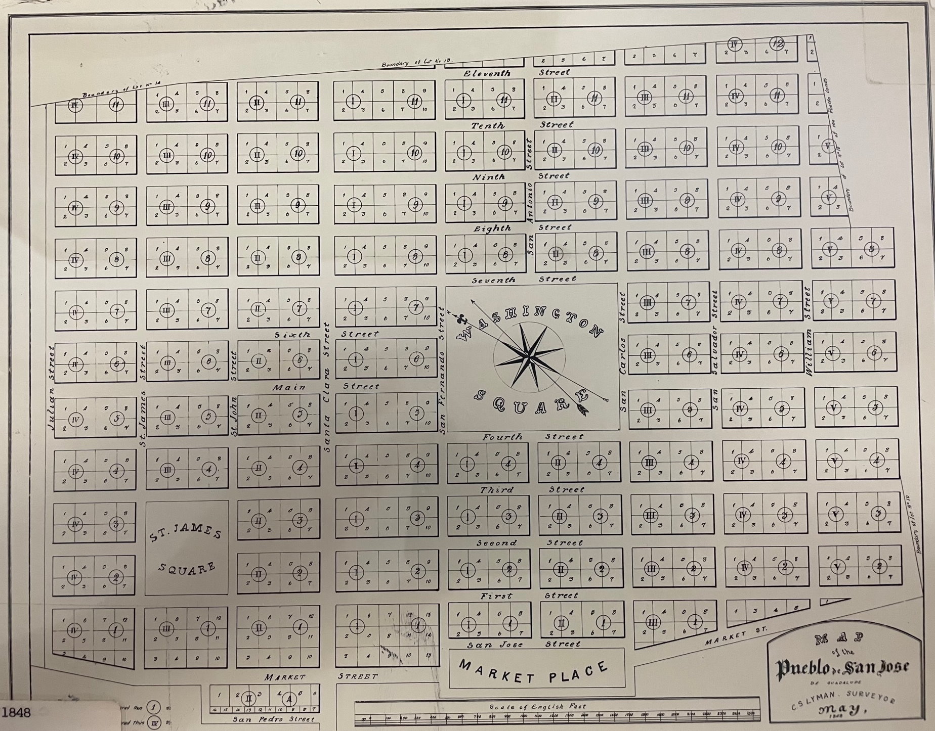
1848 Original Survey of San Jose by Lyman
Here is the original layout of San Jose by Charles S Lyman when it first formed. Lyman used the traditional grid system consisting of rectangular blocks with multiple lots. The location of the block was determined by its block number (roman number), its range number and location (north or south) relative to San Fernando street. Depending on its size, each block had 8-10 lots. Washington Square (now San Jose State University) lay at the center of the city, and the city limits ended at eleventh. However, notice that the uneven boundary. The “Boundary of Lot No. 13” would presumably be land associated with Naglee. Looked at another way, the original plan incorporated some lots on 11th street between San Antonio and and William streets (the drawing shows that B4R12S has 4 lots).

